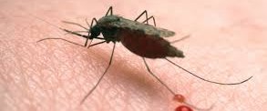
Our malaria prevention trial in Zeway was recently reanalysed. When analysing the trial results, we particularly questioned why the entomological data showed an effect of our interventions while the randomised cluster trial was negative.
In the last year, we have tried several new reanalysis methods, and we believe we had a negative trial because we needed to account for unequal community levels. In the future, we should pay much more attention to multi-level data structures.
As you may read from the paper, we postulate that visible and hidden layers could affect the analysis of such community studies. Thus, we are currently working with people familiar with remote sensing to evaluate if the distribution of, for example, maise fields plays an essential role in the variation of malaria in communities. In addition, we are trying to map the distribution of small and temporary ponds often seen as breeding sites for Anopheles arabiensis. We’re trying to use remote sensing by downloading high-resolution satellite data for our Hawassa and Arba Minch studies.
Is it time to recruit new students, master’s or PhD, with a keen interest and relevant educational background to do work on the interdisciplinary aspects of epidemiology, remote sensing and GIS?
You can read our paper by following this link, where you will find related research papers.
